





Built with love for professionals in the field services and construction industry.

Products
Company

SHARE TO



About Author
BIM coordination is the process of combining the architectural, structural and MEP models of a project into one building information modeling (BIM) environment then checking them for clashes, gaps and errors before and during construction. The goal is to ensure every trade can build what is designed in the available space without conflicts.
While BIM coordination helps teams identify design conflicts early, keeping the model aligned with actual site conditions can be challenging once construction begins.
This means teams may be working with a model that doesn't reflect the latest site conditions and that's exactly where a BIM coordination drone workflow helps them get a more accurate picture of construction progress.
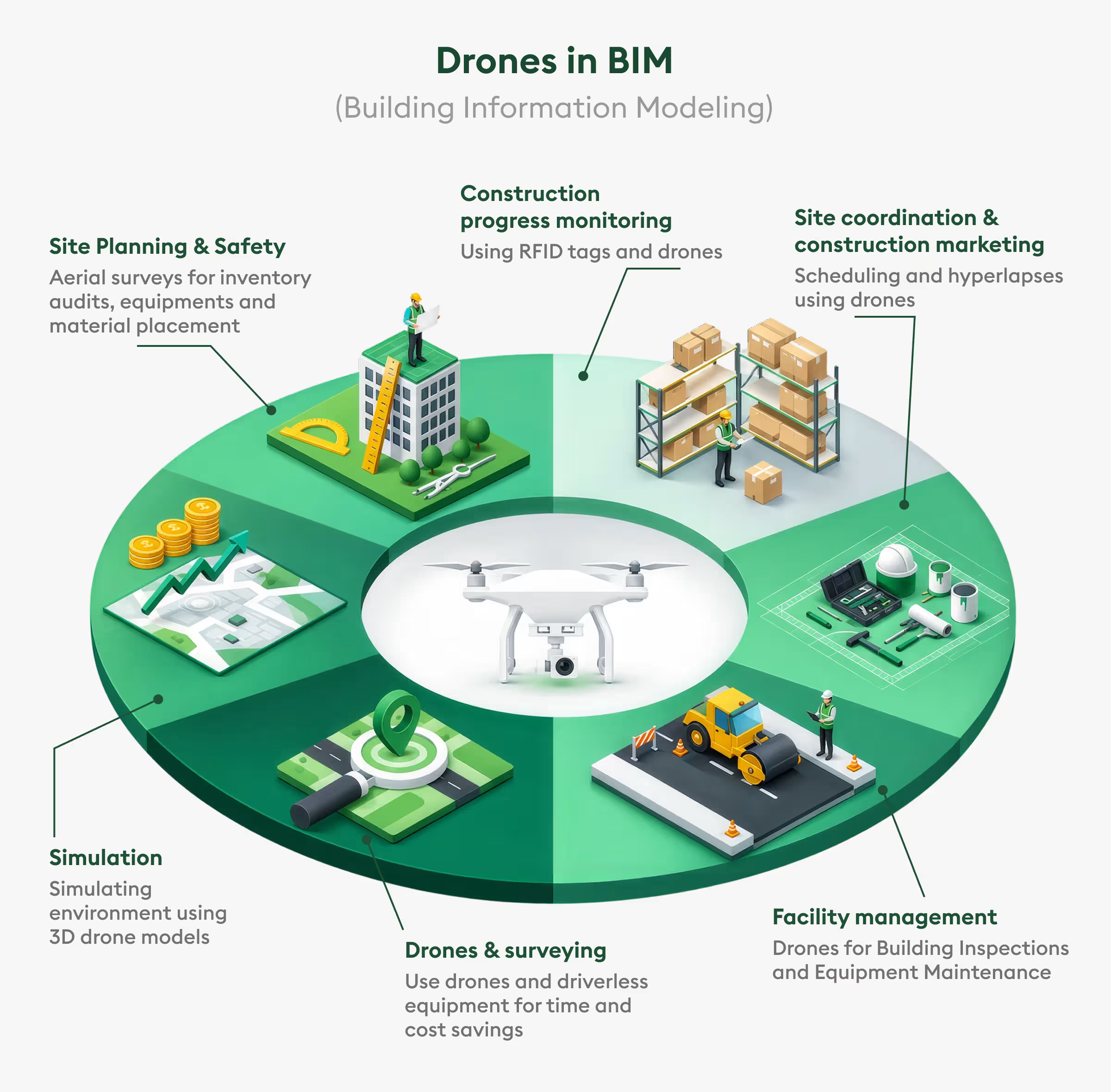
A BIM coordination drone workflow uses drone-captured site data to help teams compare actual construction progress with the BIM design model. Drones collect aerial images, LiDAR scans and video footage of the site where this data is then processed into 3D models or point clouds that BIM teams can use to identify differences between planned and actual site conditions.
Depending on the equipment and survey requirements, drones can collect:
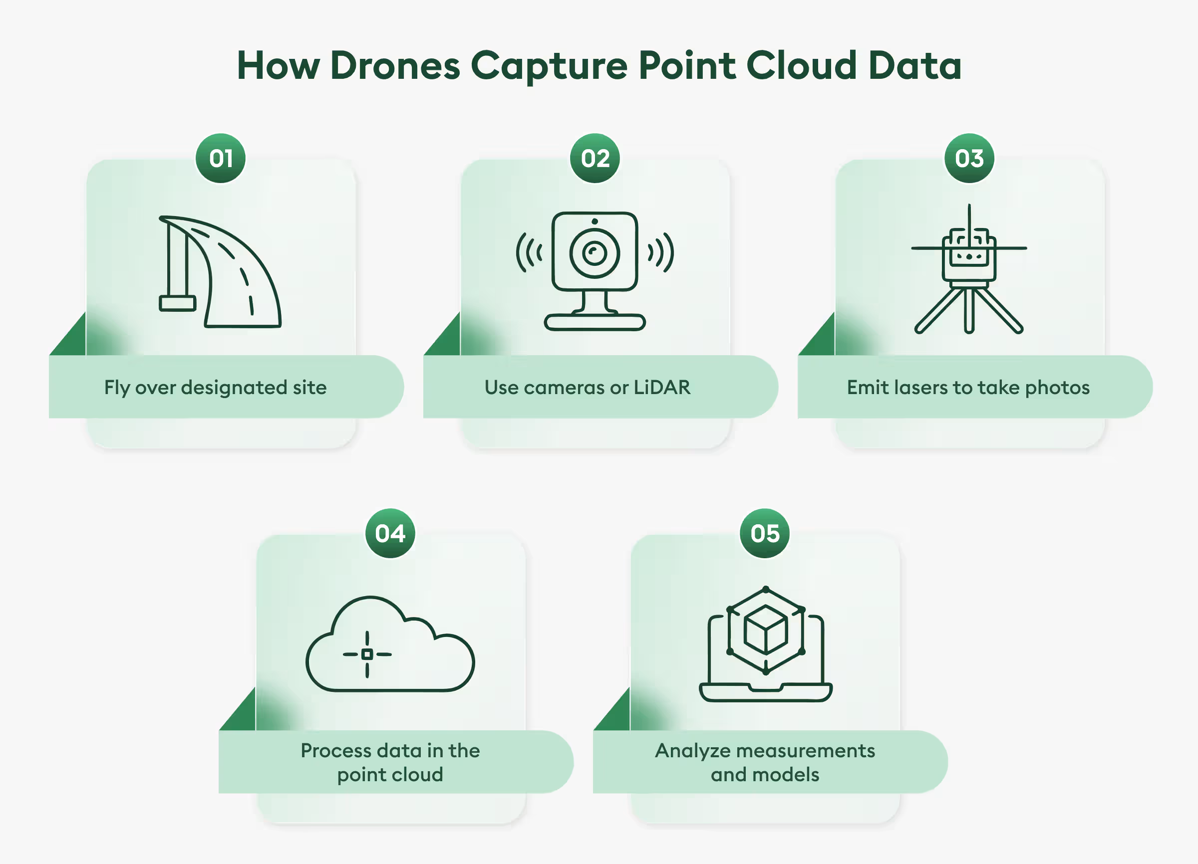
The first step in drone-based BIM coordination is to record site conditions in real time and transform the data into a format that your BIM team can use for analysis and comparison. The following steps are usually included in the workflow:
Drone flight → Data processing → Georeferenced 3D point cloud → Import into BIM coordination software → Model-versus-site comparison → Issue identification and resolution
The generated data gives your BIM team an updated view of actual site conditions where they can compare it with the design model, identify discrepancies and address potential coordination issues before they affect other trades.
This is known as current-condition capture wherein instead of relying only on design drawings or periodic manual surveys, teams can use measurable, up-to-date site data to make coordination decisions.
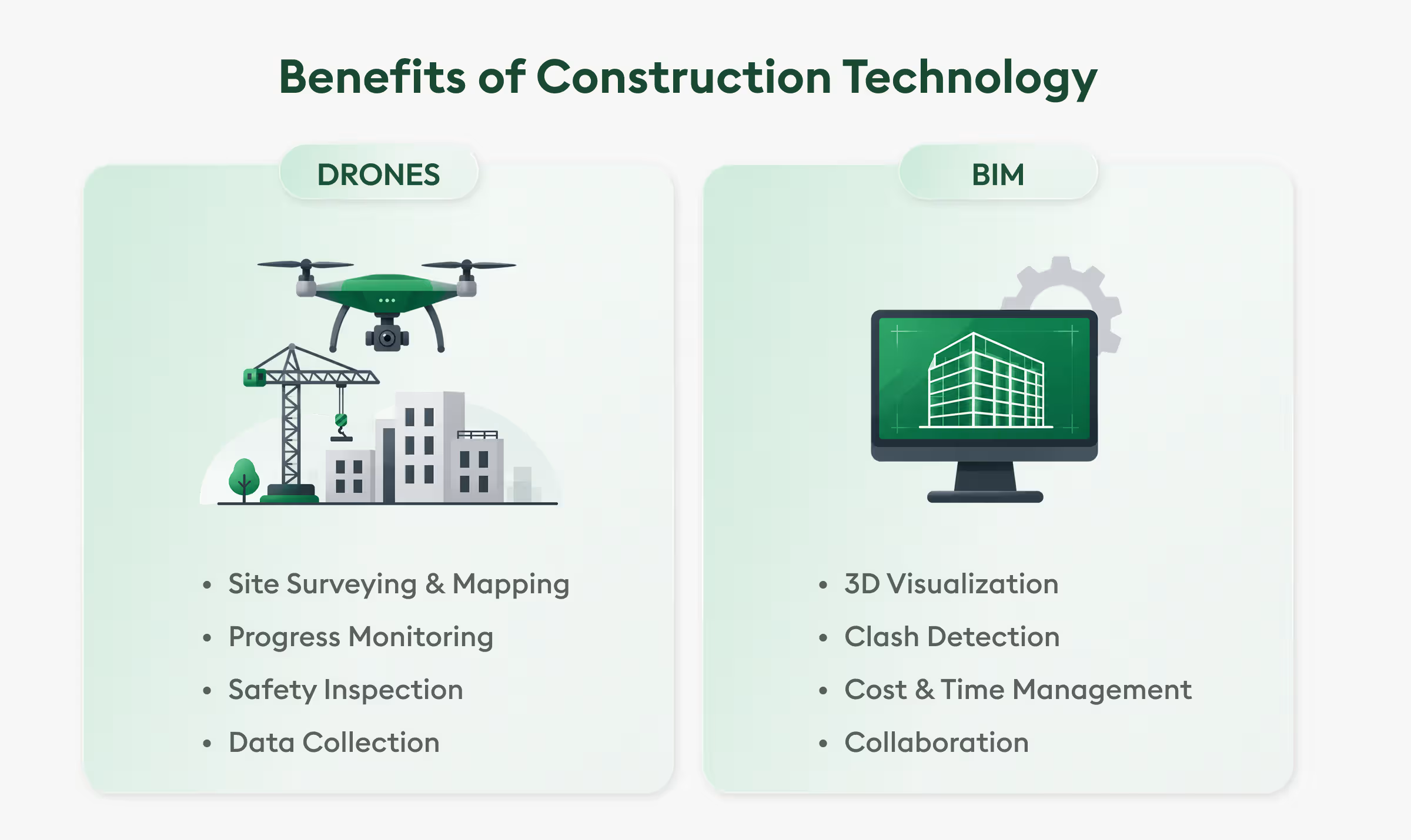
Drones can support BIM coordination throughout a construction project, from the site survey through project progress and into the field. Here are six ways they help teams accurately capture site data, identify discrepancies, and maintain construction activities aligned with the design model:
Drones can be used before the construction process begins to survey the site and document existing topography, buildings, access and surrounding areas. This provides the design and BIM team with a real starting point for coordinating the project and planning site logistics.
Regular drone flights, whether weekly or daily on fast-moving projects, help teams keep track of site progress. By comparing updated site data with the construction schedule and BIM model, teams can identify delays, monitor completed work and reduce the time between actual site changes and model updates.
One of the most useful applications of drones in BIM coordination is checking whether actual construction matches the design model. The teams can compare BIM models with point clouds created by the drone to check discrepancies in concrete placements, structural steel installations and MEP rough-in. It enables BIM coordinators to confirm the conditions in the field without relying on visual inspections or assumptions by using measurable data.
A component installed out of position can create problems for the trades that follow. For instance, the positioning of structural components may affect ductwork, pipe or electrical systems. Here, frequent drone surveys can spot these inconsistencies sooner, allowing time for a contractor to solve them before they can result in rework, delays, or disputes with subcontractors.
Access to difficult areas such as rooftops, facades, tall structures and other areas may require scaffolding or lifts and other resources on site. Drones can take detailed images and survey data from these areas without having to have workers in each area physically. This means that inspections are quicker and exposure to working-at-height hazards is lessened.
Drone-generated orthomosaics, 3D models and point clouds can be shared through cloud-based platforms. This allows architects, engineers, project owners, contractors and VDC teams to review the same site information remotely where everyone gets a clearer picture of construction progress and can make coordination decisions using consistent and updated data.
Integrating drones into BIM coordination starts with capturing accurate and consistent site data. At each stage, from planning flight paths to processing survey data, there are steps that must be taken to ensure all the information is reliable enough to be compared to the BIM model:
Use automated aerial data capture apps such as DroneDeploy to set up automated flight capture with grid or orbit paths. Grid paths suit large, flat areas. Orbit paths suit buildings and structures.
The following are some of the key points to keep in mind when planning a flight:
Commercial drone operations are conducted by many teams with enterprise drones like the DJI Mavic 3 Enterprise, specially designed for mapping.
Once the drone survey is complete, the next step is deciding how to turn the captured visuals into usable site data. Two common approaches are photogrammetry and videogrammetry wherein both use visual data to create digital representations of the site; however, they differ in how they capture and process images.
Photogrammetry vs. videogrammetry:
For BIM coordination where precise measurements are important, photogrammetry or LiDAR is generally a better choice.
Once the drone survey is complete, upload the captured images or LiDAR data to processing software such as Autodesk ReCap Photo or DroneDeploy. The software processes the raw data into outputs that BIM teams can use for site analysis and model comparisons including:
Once processing is complete, export the data in formats supported by your BIM and coordination software. Choosing compatible formats ensures that measurements, coordinates and model details remain consistent when transferring data between applications.
Import your Point Cloud into Autodesk Navisworks or BIM 360 Coordinate (included in Autodesk Construction Cloud) then run some clash detection and overlay so you can see where the work has been carried out differently from the design.
Record each finding in a Common Data Environment (CDE) with shared issue tracking. Assign an owner, set a due date and update the model once the fix is made. This is the daily routine of a BIM coordinator workflow.
Drone data can be used to identify exactly what has been constructed on-site but it doesn't show whether the design had proper coordination. If the BIM model isn't complete or there are clashes that haven't been resolved, using drone data won't give you a full picture of your team's progress. That's why having a reliable baseline model is just as important as capturing accurate site data.
Here are two factors that make a difference:
1. Level of detail: Drone comparison works best when the model meets LOD 300-400 requirements. At these levels, elements have accurate size, position and fabrication detail so structural and MEP verification against the point cloud becomes meaningful.
2. A coordinated starting model: Many contractors will have a 2D PDF/CAD design and converting this into a 3D BIM model takes expert BIM skills and lots of time. Any missing information or clashes could also impact how accurate the teams are at assessing real site conditions.
This is where Attentive.ai’s BIM CoPilot fits in. BIM CoPilot is a human-vetted, fully managed BIM service where experienced BIM engineers handle the modeling and coordination work for contractors. Teams share their design documents, usually 2D PDFs or CAD files and BIM CoPilot engineers handle modeling, coordination, clash detection, documentation and construction-ready drawing sets across all trades such as architecture, structure, civil, HVAC, plumbing and electrical trades.
Together, BIM CoPilot and drone surveys support a more connected design-to-construction workflow where BIM CoPilot helps establish a coordinated design model while drone captures provide updated information about actual site conditions. Teams can use both to identify discrepancies, track construction progress and maintain a more reliable digital twin in construction.
A typical BIM drone workflow involves tools for capturing site data, processing it and comparing the results with the design model.
While drones make site data collection faster, integrating them into BIM workflows comes with a few practical challenges. Hence, understanding these limitations helps teams plan surveys better and get more reliable results.
Drones work well for capturing exterior site conditions like rooftops, facades and large construction areas. However, interior scanning can be more difficult due to weak GPS signals indoors and tight spaces limiting drone movement.
How to handle it: Use a handheld or tripod-based laser scanner for your indoor surveys. Specialist indoor drones can also be of use in the inspection of larger or otherwise inaccessible interior areas.
Drone operations are governed by local aviation regulations which may cover pilot certification, flight authorizations, restricted airspace and operational limitations. Commercial drone operators in the US are required to comply with FAA Part 107.
How to handle it: Check local drone regulations and obtain the necessary permissions before scheduling a survey.
Strong winds, rain and poor lighting can affect flight stability and image quality which makes it harder to capture consistent data across multiple surveys.
How to handle it: Schedule flights during suitable weather conditions and keep backup dates available for weather-related delays.
Drone-generated data has to be aligned to the actual site coordinates in order to allow for valid comparison with the BIM model. Without it your point cloud and measurements may not line up with the design model accurately.
How to handle it: Use RTK GPS or ground control points (GCPs) to improve geospatial accuracy and ensure the captured data aligns with the project coordinate system.
High-resolution images, 3D meshes and point clouds can produce very large files which take a long time to process, transfer and share. This can slow down collaboration if you've got multiple teams working with the same data.
How to handle it: Use cloud-based processing and storage where appropriate. Follow consistent file-naming conventions and organize survey data by date, location and project phase.
A successful drone-to-BIM workflow requires more than operating a drone. Teams also need to understand flight planning, data processing, point cloud handling and model comparisons.
How to handle it: Start with a pilot project to help your team understand the workflow. Provide training on the tools involved and gradually expand drone-based surveys across more projects.

The biggest benefit is faster and more frequent site data collection. Drones capture current site conditions, allowing BIM teams to compare actual construction progress with design models and identify discrepancies earlier.
No. Drones capture actual site conditions through images, video and LiDAR data while BIM coordination software combines design models, detects clashes and tracks issues. Both work together to help teams compare planned designs with actual construction.
BIM coordination involves combining architectural, structural, and MEP models into a federated model, checking for clashes, assigning issues to the relevant teams, and resolving conflicts before construction. Teams use tools such as Revit and Navisworks to review models and track changes.
The 1:1 rule is a drone safety guideline that says the horizontal distance from people should be at least equal to the drone's flying height, depending on local regulations. For example: if a drone flies at 40 meters, it should maintain at least 40 meters of horizontal separation under this rule.
4D BIM is construction scheduling, 5D is cost information, 6D is sustainability and operational data and 7D is all about facility management and asset maintenance. These dimensions together extend BIM beyond 3D design by supporting project planning and building operations.